Riveroflife
Posts by :
Rainbow Springs is Ozark County’s own ‘Garden of Eden’
Posted: Sunday, August 9, 2015 12:00 am
By Tom Uhlenbrock MO Department of Natural Resources
Dorothy Carpenter describes Rainbow Springs as “a Garden of Eden.”
It’s fair to say the spectacular setting is one of the prettiest pieces of paradise the Missouri Ozarks has to offer.
The spring, and thousands of wooded acres around it, has been privately owned and preserved by Carpenter’s St. Louis-based family for more than a century.
Rainbow Springs is the best-kept secret among Missouri’s natural wonders, but that is about to change. A historic fishing lodge overlooking the spring is now available for nightly rental.
Rainbow Springs is the third largest in a state that boasts several impressive springs. The average daily flow is more than 100 million gallons of crystalline water that empties into the North Fork of the White River. Wet weather can increase the output to more than 180 million gallons.
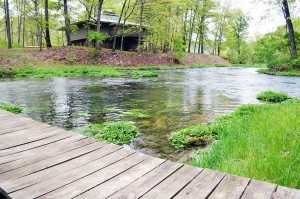
The water bursts from the base of a wooded bluff with a boil that rises one to two feet above the surface in a rocky grotto green with ferns, mosses and watercress.
Rainbow Springs originally was called Double Spring because the water splits into two branches as it leaves the pool, entering the river at two spots about a mile apart.
The rushing water doubles the flow of the North Fork, a pristine floating and trout fishing stream in south-central Missouri, some 25 miles from the Arkansas border.
A strip of bottomland forest perhaps 100 yards wide sits between the spring and the river. The spring branches flow around the land on their way to the river, forming an island.
The only structure on that island is Rainbow Springs Lodge, which was built in the mid-1960s. The lodge has four bedrooms and five bathrooms, and a distinct design with wide eaves on the roof and a stone-and-wood fireplace that soars through an atrium in the interior.
“It’s a really well thought out architectural gem,” Carpenter said. “The architect was Barry Evans. He was definitely of the Bill Bernoudy-Frank Lloyd Wright ilk.”
Carpenter, who is 65 and without children, owns the lodge with her sister and a cousin. This May, they put it up for nightly rental through River of Life Farm, a resort a mile of so downriver.
Myron and Ann McKee, owners of the popular resort, are known for their “treehouse” cabins, some by the water’s edge and others hidden higher up the hillside in the secluded river valley.
“The only problem with private ownership is you don’t have public access – Myron’s involvement solves that,” Carpenter said. “We want to make the lodge self-sustaining and let people experience Rainbow Springs the way my family has.”
Proposed for development
Carpenter’s recounting of the family history at Rainbow Springs began with what she called “the monster on the wall.”
She referred to a framed surveyor’s drawing for a proposal titled “Rainbow Springs Resort and Fisheries Inc.,” dated Aug. 10, 1927. It showed the forest around the spring subdivided into hundreds of small plots, with a hotel and garage in the middle. A road led to the “golf links.”
The company stocked the spring with rainbow trout and changed its name from Double Spring to Rainbow Springs.
Carpenter explained that in the early 1920s, people were seeking a summer escape from the soot and heat of St. Louis. Riverside clubhouse communities like Times Beach and Castlewood sprang up in St. Louis County. Rainbow Springs was on the drawing board.
In 1928, her grandfather, Birch Oliver Mahaffey of St. Louis, discovered the project and bought a fifth of the company and some 6,000 acres surrounding the spring.
“I believe from reading his letters that he wanted to gain as much control of the spring as he could,” Carpenter said. “The Depression gave him the opportunity to buy out the rest of the company and halt all development plans on the property. From then on, he strove to preserve its natural state.”
A comfortable place
Mahaffey had four daughters, and three of them hired Evans, the architect, to design a lodge for their families.
“They wanted to be able to see the spring from the lodge at all times of the day,” Carpenter said. “So they built it directly across from the spring, with glass corner windows for seeing every angle of the spring branches.”
The house was done in the mid-century modern style, with ingenious touches. The fireplace hearth is of poured and polished concrete wide enough to sit around. The chimney is fronted by slanting wood strips wide enough for storing fly-fishing rods.
Mahaffey long had the idea of cooling the lodge with the 55-degree spring water, and Evans attempted to do it, with little success. Myron McKee of River of Life has preserved the lodge’s historic furniture and artifacts, although he did update the heating and cooling system.

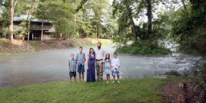
Shelby and Sheree Nold and their children, from left, Cade, 8; Gunnison, 13; Autumn, 10; and Joshua (twin brother of Cade), 8, recently moved from their home near Fair Play into the caretaker’s house next to Rainbow Springs Lodge. They will be assisting the McKees in keeping it maintained and ready for resort guests. The Nolds operate as caretakers through their Christian-based nonprofit organization, Majestic Outdoors (majesticoutdoors.com).
A stone patio is off the first floor, and a deck is on the second floor, both within sight of the spring, which is reached by a sturdy wood foot bridge. Open the bedroom windows at night and the sound of the water tumbling along fills the rooms.
“It’s a very rugged house – people came in with their waders – the oak furniture is as tough as nails,” Carpenter said. “All of us had different ideas, and the architect interviewed us and dealt with completely diverse uses for the place. I was 18 at the time and wanted space to throw 30 sleeping bags for my friends.”
Trout, eagles and hellbenders
The bottom floor of the lodge has a kitchen, utility rooms, half bath and a large open living and dining room with two sets of sofas. The second floor has four spacious bedrooms, each with two single beds and a full bath.
The second floor has a balcony looking down on the fireplace and first floor. The balcony was made wide enough to hold extra beds, or sleeping bags. Cots are provided, bringing the maximum occupancy to 14.
The nightly rental price, with a two-night minimum, is $850 for up to eight people. Each additional adult is $87.50 a night; children younger than 12 are $43.75. For more information, visit RiverOfLifeFarm.com.
Fed by springs and protected by national forest for the top two-thirds of its 50 miles, the North Fork has one of the largest self-sustaining wild rainbow trout populations in the Midwest.
Resident bald eagles live in the valley, and the river was chosen by wildlife researchers for a restocking program of endangered Ozark hellbenders, a large, aquatic salamander.
The family maintains control of Rainbow Springs and some 1,400 acres of land around it. “Preserving the forests of the watershed ensures protection of the spring’s purity and the North Fork’s incredible scenic beauty,” Carpenter said.
Arrowheads and other archaeological evidence indicated the spring was visited by the first Americans. In later days, Jesuits used the lodge for spiritual retreats.
“I can’t let the spring be desecrated – it’s a special place,” she said. “The Indians felt it was sacred. I feel that way, too.”
Rainbow Springs Lodge Article
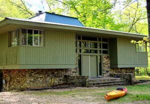 The North Fork of the White River is known for a number of things, floating and trout fishing in its cool, clear water chief among them.
What is unexpected is a mid-century modern lodge perched atop an island overlooking Rainbow Springs on the North Fork. Designed by architect Barry Evans, the mid-’60s lodge almost blends into the landscape, but contains a delightful number of period-perfect architectural details inside and out.
Dorothy Carpenter says the home was built on land acquired in the 1920s by her grandfather Birch Mahaffey. Rainbow Springs itself wasn’t for sale — it was owned by a company with plans to develop around it — but an adjacent 6,000 acres was. So Mahaffey bought up the surrounding land and bought a one-fifth interest in the company. “That makes it seem obvious to me that he wanted Rainbow Springs,” Dorothy says.
When the stock market crashed in 1929, “that stopped the development in its tracks,” Dorothy says. Birch bought the land and it remains in the family to this day.
Over the years, the family built and rebuilt a series of fishing lodges. The moisture of the valley doesn’t do wood any favors. But when it came time for Birch’s four daughters to build a new lodge, they went in a fresh direction.
They decided to move the lodge to an island where they could just look outside to see the river and springs. They enlisted the help of architect Barry Evans. “Their main concern was, we want it to blend in. We didn’t want to have something that expands like a monument … they wanted it to be a platform from which you could view the spring,” Dorothy says.
The architect interviewed everyone in the family before settling on a design. The result incorporates elements of Frank Lloyd Wright and the modern esthetic of the ’60s.
“I always think as far as the style goes, it’s very much like a place Don Draper would take his clientele for a fly-fishing trip,” Dorothy says.
The family enjoyed the lodge for decades. Some used it as a retreat, others for fishing and hunting. “I just wanted to have a whole bunch of people down there and listen to loud music,” Dorothy says with a laugh. “… The diverse usage of the place was just incredibly wide. He somehow designed a house that fit all the uses we wanted.”
Over time, though, maintenance became an issue and, of course, occasional flooding. With the family living four hours away, they were dependent on caretakers to keep the house up. The expenses were mounting and, finally, the family decided maybe it would be best to sell it.
Dorothy had a different idea. “I say the important thing is to preserve the spring. You don’t sell the spring because you don’t want the house,” she says. “I was going to suggest we tear down the lodge and go back to having a simple cabin on the other side of the spring.”
That’s about the time she met Myron McKee, owner of River of Life Farm and Treehouse Cabins, just down the river.
When she floated her idea, “Myron said, ‘Uh, uh, wait a minute.’ He suggested that he use it and take care of it.”
She mentioned flooding and maintenance issues. “‘Well,’ he said, ‘This is a historically wonderful lodge and you can’t tear it down. It’s not exactly falling apart, just frayed around the edges.'”
That’s all Dorothy needed to hear. She, her sister and a cousin bought the property from the family. Myron pitched in money to help replace flooring and drywall, fix the leaking skylight and generally spruce the place up with new paint and air-conditioning units.
“He put a lot into that house. He was meticulous about keeping the character and design … I can’t believe (the answer) was just downstream, just when I needed it to happen. I was searching for the way to save the spring, and here comes Myron,” Dorothy says.
The goal now is to make the property self-sustaining by earning money through renting the lodge. Half of the profits are invested in maintaining the property and Myron’s half of the profits go to support the Kolkata Tree House Home, an orphanage his son founded in India. They have a full-time caretaker and Myron will manage the property just as he has his 11 other rental cabins for the last 20 years.
“We have only our lifetimes to make this self-sustaining,” says Myron.
“Here’s what I really want to do,” Dorothy says. “I want someone to have it. … I think we hope whoever gets it next — whether it be a conservancy or a person, whoever does — I don’t want them ever to be tempted to sell out Rainbow Springs just because of a money problem. I want the spring to be self-sustaining … so no one is tempted to sell it for development or anything crazy.”
“I feel I owe it to human beings to preserve it, and my sister and my cousin feel the same way,” she says.
Want to go?
What: Rainbow Springs Lodge, a mid-century modern lodge located on an island overlooking Rainbow Spring, on the North Fork of the White River.
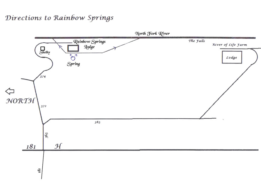
Where: Available through River of Life Treehouse Cabins, 1746 River of Life Drive, Dora.
Cost: $850 per day for up to eight people (two-night minimum); can accommodate up to 14 lodgers for additional fee.
Info: treehousecabins.com or 417-261-7777.
North Fork Tapestry
The River and Its People Tell Their Story
by Jim Cox
(Originally published in the West Plains Gazette, Number Twelve, May-June, 1981.)
Reprinted with permission.
The surface of the North Fork River was calm as I pushed the canoe off the gravel bar and into the shallow water at the Hammond’s Mill river access.
The power of the moving water wasn’t apparent until a few yards downstream, where the river is funneled into a narrow curved channel. The canoe shot forward before I could get balanced and pick up my paddle. Then I could understand how the river was able to turn the massive mill stones of the old grist mill that once stood near this spot.
As the stream veered to the right, I innocently expected to see the canoe turn with it. But the bow stubbornly pointed toward the left bank, and I started drifting sideways. A stroke of the paddle on the left side slowly swung the canoe around. But it also moved me faster toward the bank!
Before I could complete the turn, the bow crunched into a mass of roots on the bank. The current suddenly jerked the other end around. The rushing water hit the canoe broadside. Cold water came pouring over the other side as it tipped.
Shifting weight, I quickly righted the canoe. Too late. I was sitting in six inches of water, with the life cushion and waterproof containers floating around my knees.
It was an overcast day with rain threatening, so l felt lucky there was no one else around to witness this debacle as I dumped the water out of the canoe, rearranged my gear and made a fresh start.
A friend told me later that exactly the same mishap occurs to countless other canoeists who put in at Hammond’s Mill for the first time. We both laughed when he pointed out that my dunking had taken place near the community’s traditional “baptising hole.” [sic]
This was the awkward beginning of a one-day solo float trip on a short stretch of the North Fork River in Ozark County, Missouri, in the spring of 1981.
The purpose was to gather material first-hand for a feature on Ozarks rivers, which seemed like a pleasant enough assignment. (Every stream has its unique features, of course. At the same time, the North Fork provides a sample of the richness and variety that can be found in hundreds of miles of clean, floatable waters all over the region.)
Yet there was a special inspiration behind this writing project, beyond the “playground” aspects of the Ozarks that are plugged in many publications. There was a desire to portray the float trip as something more than a cheap vacation. Many of the people we see racing along the surface seem to be missing a lot of what the river has to offer.
There are other dimensions of the river that are often overlooked, which can enhance the floating experience. Yes, there are some excellent published canoe guides, but even they deal mostly with the fishing and floating characteristics of the water. It’s also important to learn about the plants, wildlife and historical sites that will be seen along the way. Only then does it seem worthwhile to allow the current to carry the canoe at a quiet, leisurely pace. The river is seen as something very much alive. There is a subtle pleasure in becoming part of it, respecting it and letting it tell its own story.
A detailed topographical map also shows that the river and its immediate shoreline cannot be separated from the hollows, ridges and caves at every turn. They are interesting not only for their geological kinship to the river but for the pioneer families they are named for — names like Collins, Gunter, Kelly, Hodgson and Guthrie. The dramatic stories told by their descendants added a lot of meaning to this float trip. By the time it was over, the North Fork had become more than a winding ribbon of water. It was a living tapestry, in which man and nature, space and time, were interwoven.Hammond Mill, shortly before it was torn down in the late 1930’s.
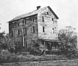 Photo by Clay Anderson
Hammond Mill, shortly before it was torn down in the late 1930’s.
HAMMOND’S MILL
Hammond’s Mill river access, where many canoeists put in, preserves only the name of the water-powered grist mill that once turned locally grown wheat, corn and oats into meal and flour.
Use of the site for water power dates back to 1856, when a man named James built a log mill on a bluff on the west bank of the river. James was hanged nearby by bushwhackers at the close of the Civil War, and for many years a marker told where his grave could be found.
The property was acquired after the war by a man named Poole, who replaced the log mill with a frame structure. This mill burned in 1876, but was replaced the following year. Ox teams were used to haul stones and timbers for a dam, to provide a better head of water for the undershot wheel.
In 1902 a man named McCabe established a post office and general store near the mill.
This mill continued to operate until it was washed away by a flood in 1904. Jim Duffy, the owner at the time, sold the property to Tom Hammond, who had another mill built on higher ground in 1907.
After Hammond’s mill ceased operation in the early 1930s, the milling equipment was removed, including the huge stone buhrs said to have been imported from France. The three-story structure quickly deteriorated and was demolished a few years later by developers who had a plan (which they later dropped) to build a dam on that part of the river.
Old mills like this, whether preserved or long decayed, remain as symbols of the Ozarks pioneer heritage. But they were more than pieces of machinery. They were the hub of the economies of the first wilderness settlements. Much is owed to the skillful mill wrights and enterprising millers who made this possible.
A new bridge a few hundred yards upstream from the national forest public campgrounds near Hammond’s Mill whisks motorists high over the water today. Old timers tell what it was like when the only roads along the river were rutted wagon tracks, and bridges and ferries were unheard of, when long, hard journeys were involved in getting to the half dozen mills that operated at one time or another along the North Fork.
Beyond the rushing waters below Hammond’s Mill, the river returns briefly to a wide, calm expanse of water, with rugged limestone bluffs towering above. Some rock formations project over the water. Every ledge is crowded with mosses, broadleaf plants and colorful wildflowers. Spring water trickles from fractures in the rocks.
Many eons have passed since these limestone deposits were formed in the bed of an ocean, heaved up, then imperceptibly worn away to form the walls we see today. Untold generations of living creatures have found shelter in their crumbly niches.
As I drifted with the current, I found that the air above the water also flows along with the river, with noticeable pools and eddies that are shaped and channeled by the surrounding terrain. Several times I drifted into fragrant pockets of air that flowed out of lush groves of oak, dogwood and sycamore trees along the banks. Near waterfalls, the air picked up the pungent smell of aquatic vegetation. Nearby bottom lands added the flavor of newly mowed hay.
I had almost passed Blue Springs before I saw what it was. By now I had learned the trick of turning the canoe without taking up the whole river (paddling backwards on one side), so I worked my way back against the swift current for a closer look.
The spring obviously gets its name from the bluish haze of the frigid water as it wells up from the sides of a picturesque circular cove. The cold water and the shade from tall trees on the surrounding ledges gave the air a noticeable chill.
Several stretches of deep, smooth water gave a good view of the many species of fish found in the river. Suckers took little note of the canoe as they probed over snail-covered rocks on the bottom. Striped bass darted away when pursued closer to the bank. Nervous schools of perch scattered and regrouped. Fish of all sizes broke the water to feed on hovering insects.
COW FORD
A lively rippling of the water ahead signaled I was approaching the lower edge of one of the many limestone ledges that make up the riverbed as it stair-steps its way down to Lake Norfork near the Arkansas line. This section, below a tributary called Crooked Branch, has been known from pioneering days as Cow Ford, one of the dozen or so spots along the river that were used for low-water crossings.
One of the area residents I met later was Walter Collins, 91, who was born a mile or so from Cow Ford. Collins Ridge was named for his grandfather, Ephram Collins, who homesteaded there before the Civil War.
In those days, Ephram supported his family largely through hunting. He often told his children and grandchildren about the time he heard the terrifying squall of a panther, or mountain lion, behind him as he was tracking game across the river. Cocking his muzzleloader, he kept walking as fast as he could until he decided the panther wasn’t stalking after all. Later he found the carcass of a farmer’s hog that had been tied to a tree and died from the heat. He saw that something had been feeding on it, and he figured that’s what saved him.
Another time, Grandpa Collins and another farmer had to go to Hammond’s Mill with a load of corn. After struggling through Cow Ford with the heavily loaded wagon, they found the bank was too steep for the yoke of the oxen to pull the rig up out of the water. Collins jumped out of the wagon into the water. The load was still too heavy. “Throw one of those sacks of shell corn over my shoulders. I can carry it,” he told his companion. This lightened the wagon just enough for the oxen to finish the pull.
Since trips like these were major undertakings, the two men stayed all night at the mill so they could return home with their flour and meal the next day.
Just beyond Cow Ford, the river divides, forming one of the many small islands encountered on the trip. It was hard to tell which channel was the deeper, so I landed on the island to get a closer look and talked for a while with four canoeing couples who had stopped there to fish.
The channel I finally chose turned out to be deep enough, but several submerged rocks gave the canoe a jolt as it went over them. It helps to have another person along to keep a lookout for such hazards.
The canoe was propelled into another narrow channel that careened sharply to the right as it collided with the water coming from the other side of the island. The canoe was tossed about by the turbulence, but I sailed through with regained confidence.
Then an earlier pattern was repeated — a long stretch of calm, deep water bordered by ancient bluffs. I drew up to a gravel bar to relax and enjoy the view. No luck. The trashy remains of an abandoned camp site just couldn’t be ignored. Beer cans, aluminum foil, food wrappers and cigarette packages had been dropped and forgotten. Ashes in the fireplace were still warm. As I put the trash in a sack in the bow of the canoe, I wondered if I would meet the thoughtless perpetrators of this mess downstream. Why did they bother to even come here if the beauty of the river didn’t mean anything to them?
The people I had passed earlier caught up with me. It had started to rain, and they all took out ponchos and continued fishing.
Another group of floaters downstream had found shelter on a gravel bar beneath an overhanging bluff, and, having no rain gear, I decided to join them. Everyone pooled scraps of dry paper and managed to start a small, smokey fire with dead twigs and drift wood.At the old swimming hole in the 1930s.
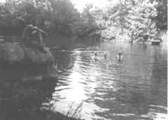 At the old swimming hole in the 1930’s
THE OLD SWIMMING HOLE
After the rain let up, I was able to set out again. A few more turns led to a deep pool surrounded by flat rocks. I recognized this as the old swimming hole Walter Collins had talked about. It had been a popular gathering place for generations.
To appreciate this requires picturing a time, many years ago, when it was rare to see anyone floating the river. Groups of boys who sneaked away from hot chores for cool swims wore only their “birthday suits” as they dove from rocks and frolicked in the water.
On Sunday afternoons, larger groups from Dora, Pottersville and even West Plains would descend on the swimming hole in wagons and Model Ts for big picnics. It was not unusual to see two or three hundred people there on occasion. Horses and dogs would mingle with the swimmers, and some folks would even drive their cars out into the water for an “automatic car wash.”
People seldom go there anymore, and the old road leading to the swimming hole is grown over with trees now, Collins said.
Below the swimming hole is another crossing known as Gunter’s Ford, named for Sherman Gunter, a pioneer farmer whose land bordered the west side of the river. Merchants from Dora and other communities west of the river used this crossing to haul lumber to West Plains and to bring back sale goods. Roads from other fords downstream joined this one on the east side of the river and continued on through Pottersville.
Years ago, anyone who wanted to cross the river, to fish or to water his stock had free access to the riverbanks. Also, the land that was not under cultivation was considered open range, populated by roaming herds of cattle and half wild hogs. Numerous “squatters” eked out livings in isolated hollows.
To keep the woods open, farmers would burn them over every spring. These practices, combined with unrestricted hunting, decimated the wildlife population by the early part of this century.
Two huge springs originate from what was the Gunter farm and contribute their flow to the river below Gunter Ford. Everyone called them Double Springs then. A water-powered grist mill once turned at the mouth of one of the springs. It was owned by Alva Hodgson, who had previously built the Hodgson Mill on Bryant Creek, which, among others, is still in operation today.
A big flood in 1915 washed the mill away, and all that remains today are the concrete footings. People still tell about the pumpkins and mill parts they found strewn about the bottoms after the flood waters subsided.
The Gunters, who later ran a steam powered sawmill in one of the hollows, had to move their equipment to higher ground during one flood. They tried to save one big saw log by chaining it to a stump. When they came back later, the log, chain and stump had all vanished.
Double Springs also used to be the scene of big Fourth of July picnics that drew people for miles around, according to Birda Gunter, now of West Plains, who was married to the late Clarence Gunter, one of Sherman’s sons.
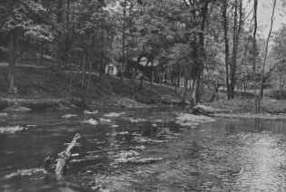 Rainbow Springs (formerly Double Springs) and the original Mahaffey lodge, in the 1930’s.
RAINBOW SPRINGS
In the late 1920s, Birch Mahaffey of St. Louis bought the Gunter property, fenced it, and started to develop the springs into a commercial fishing resort. That was when it became Rainbow Springs. For easier access from West Plains, Mahaffey had a wooden bridge built across the river at Gunter Ford.
Natives who had witnessed floods on the North Fork raised their eyebrows when they saw this “cornstalk bridge,” with its numerous pilings inviting the accumulation of floating debris. When someone asked young Clarence Gunter how long he thought the new bridge would last, he pointed to a nail high on the trunk of a tree and said, “I’ve seen the water get that high.” It was eight feet above the bridge.
A heavy rain came the day after the bridge was finished, old timers recall. In the flood that followed, the bridge was swept away like a toy.
The loss nipped Mahaffey’s commercial venture in the bud. But his descendants have continued to use Rainbow Springs as a private weekend resort. Full-time caretakers (including Clarence and Birda Gunter from 1942 to 1971) have farmed the land and made sure that hunters and river users observe the many “No Trespassing” signs.
One by one, other farms along the river were fenced and restricted to private use. A limited number of public access points and public campgrounds are located on stretches of the Mark, Twain National Forest that border the river, however.
I found that most of the landowners, while concerned about the increased volume of river traffic, are tolerant and even friendly toward canoeists as long as they limit their stops to the gravel bars and take their trash with them.
Turtles sunning themselves on a half submerged limb slid into the water as I approached, before I could identify them. There was a similar problem with a large blue-gray water bird that kept moving downriver ahead of the canoe. There were few suitable stopping places for getting closer looks at flowers. The easiest study was made of a kind of water lilly with yellow blossoms found in several shallow backwaters. Large vultures also formed unmistakable silhouettes in the tops of several dead trees.
One thing was certain, most of the plants and wildlife close to the river are very different from those found in the uplands of this same general area. This was part of a unique, delicately balanced ecosystem.
A few hundred yards past Rainbow Springs, where the combined waters rush over a boulder-strewn bottom, the canoe ran into a shoal of water, the roughest encountered so far. But there appeared to be no danger for anyone who is alert and holding the canoe on a steady course.
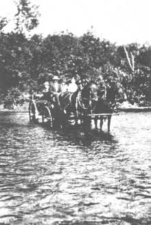 George Eckart and family crossing Kelly Ford, 1913.
KELLY FORD
This is just above Kelly Ford, another major crossing point before the days of bridges and fences. It was named for Henry Kelly, who farmed the neighboring bottom land in the early 1900s. The story is told of a team of horses that drowned at Kelly Ford when the driver ignored the warnings of neighbors and tried to take them across during high water. Usually, when the water got over about mid-thigh, there was no question in anyone’s mind that it was too dangerous to cross. There was nothing to do but wait – which might be hours or even days.
Walter Collins’ sister-in-law, Grace Paul Kelly, 92 was married to John Kelly, one of Henry’s sons. While visiting here from Colorado recently, she told of times when high waters came up as far as their front porch in the hollow. Whenever Kelly Ford was too deep to cross on foot, they often would hear neighbors hollering from across the river asking Mr. Kelly to bring them across in his big john boat.
Across the river from Kelly Hollow, below Rainbow Springs, is “Tater Cave.” Early settlers discovered its constant temperature and humidity made it an ideal place to store their sweet potatoes through the winter. As a young girl, Mrs. Kelly had the job of fetching potatoes from her family’s barrel in the cave. Ducking under the low entrance with a burning pine knot, she had to look out for snakes that found he cave an equally ideal place to spend the winter.
There are several other large caves in the neighborhood that adventurous youngsters liked to explore as far as their pine knots would last.
They usually tied a string to a tree near the entrance, unrolling it as they went so they could find their way back. But one group of youngsters who went into a cave on the Kelly property got “claustrophobia” squeezing through a narrower passage and emerged badly frightened. After that, Mrs. Kelly decreed there would be no more expeditions into the cave while she lived on that property.
THE “OTTO ROCK”
A tamer and universally enjoyable pastime was fishing. There were no trout in the North Fork until the owners of Rainbow Springs built a hatchery and started stocking them. But there was plenty of sport and good eating from carp, perch, goggle eyes, catfish, pike, bass and other fish that are native to the river. Crayfish, or “crawdads,” were delicacies for many river people. Eels used to be common, but the dams built downstream make it impossible now for the eels to migrate upstream to spawn, some say.
Among the fishermen in that part of the river were George and Otto Eckart, brothers who homesteaded land along there in the 1890s. As artists in Chicago, they had been friends of Michael Brand, founder of the fruit empire at Brandsville. At Brand’s invitation, they came down one summer to pick peaches. They fell in love with the river and brought their families back the next year. They moved back to Chicago a few years later, but they kept the land and returned for extended vacations each year. Their attachment to the river has endured for succeeding generations, as it has for the descendants of other pioneer families.
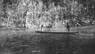 Crossing the North Fork in a gigging boat, 1920s.
During hard times, many families or their offspring were forced to leave their homes along the river and seek jobs elsewhere. But it’s amazing how many of them later found their way back as soon as circumstances allowed.
George Eckart’s son, Kurt, returned to live near the original family home above Portwood Hollow when he retired. Otto Eckart’s son, Vernon, retired in West Plains, but enjoys visiting the Eckart river property on weekends. They both mentioned that Vernon’s father spent so much time fishing from one big rock below Kelly Ford that it became known as the “Otto Rock.”
The popularity of gigging, or spear fishing, for suckers at night gave rise to the unique Ozarks gigging boat. It was a long, flat-bottomed boat that was propelled easily up and down the river with long poles. To keep the seams tight it was never taken out of the water.
The classic gigging boat, according to the Eckarts, was made from just three tapered pine boards -one 16 to 18 inches wide for the bottom and two 14 inches wide for the sides. Of course there had to be some splices lengthwise when the boats got up to 32 feet long. But it would be hard to find boards wide enough to make such boats today.
The giggers would set a “fire jack” (a wooden platform covered with wet mud) across the middle of the boat. Burning pine knots would be stuck into the mud like candles in a cake, and the light would draw fish near the boat at night.
Every so often in summer, the neighbors held big fish fries in Kelly Hollow. After gigging all night, the men would come back with their boats filled with suckers. Their faces still black with soot from the burning pine knots, the tired men would rest in the shade while the women fried the fish and the children took turns churning the ice cream. There were always bawling babies and flies everywhere, but everyone had a great time, the Eckarts remembered.
McKEE BRIDGE
At Casey Ford, less than a mile below Kelly Ford, I came to a concrete bridge with the name McKee painted on the upstream side. This, I learned, was constructed for private use in 1974 by Warren McKee, 61, who owns property on both sides of the river and runs a sawmill on the old Kelly place.
His father, Arthur McKee, moved his family to the river from Pottersville in 1932. Neighbors and relatives questioned his economic judgment, but the land was cheap and had plenty of marketable timber on it.
Although the Depression years kept everyone’s attention mostly on the immediate problems of survival, McKee points with pride to the benefits of more careful land management since the days of the early settlers. The woods are now populated with turkey and deer, something his father rarely saw.
McKee also said he has learned to appreciate more of the natural beauty of the area in recent years. “I always liked to hunt and fish, but I guess I never paid much attention to the trees and the flowers. Then one time a guy was telling me how pretty he thought they were. Ever since then I’ve noticed things like that.”
Gardens and livestock meant people who subsisted along the river usually had enough to eat, McKee said. But as recently as 25 years ago life was almost as hard as it had been for the original settlers. Water was hauled long distances from springs. Clothes were washed by hand on scrub boards. Because there was no refrigeration, the kitchen ranges had to be fired up even in the heat of the summer to can all the meat from hogs when they were butchered. The last chores of the day were done by the light of kerosene lanterns, before everyone fell into exhausted sleep.
Today, even with greater material comforts, it’s still hard for river residents to make a living. Beyond a handful of farmers, most local people now fit into three categories: retirees, weekend cabin owners and canoe outfitters.
An interesting exception is McKee’s nephew, Myron McKee, 29, who moved back here from California with his wife, Ann, in 1977. They are building their own home across the river, using precut logs from the McKee sawmill.
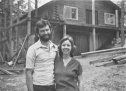 Myron and Ann McKee
They are a happy-looking couple, although the North Fork holds some poignant memories for Myron. When he was nine years old, his father was drowned while trying to cross Kelly Ford on horseback during high water.
Within a year, the family farm was sold and the family moved away. Myron’s mother wanted to leave to start a new life, but he never stopped thinking of the land along the North Fork River as home. As he was growing up, he dreamed of returning someday.
But Myron and Ann had to consider the limited economic opportunities in the area. Their experience packing fruits and vegetables during the summer in California suggested a solution. For the last several years they have earned enough money through seasonal work elsewhere to allow them to live on the river the rest of the year. When I talked to them, they were getting ready to leave to pack tomatoes in Arkansas and perhaps move on to California for the fruit harvests.
THE FALLS
Upriver, just about every group of canoeists I met asked in worried tones how far it was to (shudder) The Falls, that nemesis of floaters that manages to devour about one or two canoes per weekend. The Falls, located just below Casey Ford, actually present no great hazard. It’s a short drop, with several clear openings between the rocks. Trouble occurs only when approaching canoeists get panicky, decide to go through a different channel at the last second and end up drifting sideways into some rocks. The pressure of the water can hold the canoe against a rock like a vice and even fold it up like a jackknife.
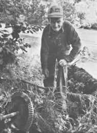 Redman Hensley shows the remains of a grist mill he used to operate on the North Fork River
GUTHRIE FORD
A mile beyond The Falls, just above Guthrie Ford, an old metal roofed log house is visible from the river. It hasn’t been lived in for several years. But later I traveled several miles of backroads to meet the original owner, Redman Hensley, 73, who lives with his wife in a mobile home a short distance away.
This was a particularly fortunate discovery, for here was a living example of the old-fashioned ingenuity that early pioneers depended on in the face of scarcity and isolation.
His father, James Hensley, had traded 160 acres of land to the west for these 80 acres along the river in 1915 because he was interested in water power. But being advanced in years when the move was made, the elder Hensley was able to get only as far as building a mill race before his death in the mid 1920s.
It fell to Redman, only 15 years old at the time, to complete his father’s ambition. He had only eight years of formal education, but he also had inherited his father’s mechanical aptitude and self-confidence. Over a period of several years, whenever his farm work allowed, he carefully surveyed the banks of the river and charted the rise and fall of the waters. At night, he studied science books he borrowed from a school teacher friend and taught himself the basics of mechanics and electricity.
Using many parts salvaged from old cars and tractors, he eventually built an undershot water wheel at the end of the mill race below his house. The end of the shaft had a beveled gear that transferred motion to another shaft running uphill to a mill house, turning stone buhrs that ground grain for himself and neighbors. Later, he connected an electrical generator to the shaft and had a business of charging up people’s batteries for their radios and lights.
After about 15 years, the bearing and gears of the water wheel finally gave out and the whole thing sort of fell apart, Hensley said. He substituted a gasoline engine and continued running the grinding mechanism for several more years. Today only a few metal fragments remain as evidence of where the water wheel and mill had stood.
Living today without electricity, he said he would like to generate his own power again. But he wouldn’t use water power anymore. Always reading and experimenting, he’s going to see what he can do with solar energy, he said.
BLAIR BRIDGE
One of the early settlers east of the river between Guthrie Ford and Blair Ford was James Trump, who moved here from Oregon in 1908. One of his sons, Walter Trump, 93, now of West Plains, remembers harvesting wheat with a grain cradle and taking it downstream to a mill at Patrick Ford, where Patrick Bridge is now. He also made his own apple cider. Both the cradle and the cider press are family heirlooms.
One of Walter’s favorite pastimes was setting trot lines in the river for eels, which were baited with chunks of rabbit meat. The eels were skinned and fried, just like catfish.
“Those were the good old times . . . then. I don’t think I’d want to see them again,” is Walter’s assessment. Once, while crossing Blair Ford in a buggy during high water, his wife had to hold on to the children to keep them from being swept away by the current. During the drought years of the 30s, when many springs went dry, he and other farmers would drive herds of cattle and hogs down to the river for water.
The river had more than economic importance. When Walter and his brother went to Kansas in the summer to find work during the wheat harvests, they were always glad to get back and see the beautiful hills along the river again.
In 1923, after one stay in Kansas, they returned to an even more pleasant sight. A man named Young had completed a bridge across Blair Ford, the first on the North Fork River. This was destroyed by a flood ten years later, however, and until the present bridge was built in 1935, residents had to go back to fording the river.
One of the people helping to build the new bridge was Beryl Pettit. He and his wife Betty now run a canoe rental and campground at Blair Bridge, one of the first on the North Fork.
The image of a tapestry of interwoven lives seemed all the more appropriate when Betty Pettit explained that she is the sister of Warren McKee’s wife, Naomi. They are both natives –granddaughters of James Trump.
The Pettits, who returned to live on the river after being away many years, come across as typical, friendly Ozarks people. They love the land and the river, yet maintain an open, helpful attitude toward the weekend canoeists. They enjoy serving the 95 percent of river users they see as “good people who respect the river” and try not to get too vexed at the other five percent.
Adds their son, Pat, “We expect to see some people let off a little steam when they come here. If I were cooped up in an apartment in Kansas City all week, I would too. I enjoy seeing them have a good time. They can’t really hurt the river as long as they keep it clean.”
He said most of the trash found in the river gets there by accident when canoes are overturned. Even this small amount has little lasting effect. “The trouble is we haven’t had a good gully washer in two or three years to flush it all out.”
This perhaps summarizes the situation of the rivers today. The uses people have made of the river — for food, transportation, water, power, recreation — have changed over many generations. But there is general agreement that the river is there to be used and enjoyed The only question is how much use the river’s limited resources can absorb.
It seems to come back to the kinds of attitudes people bring with them. If a float trip is thought of as a brief visit with a good friend and we act accordingly, we are sure to be welcomed back again with a smile.
North Fork Tapestry is copyrighted material and may not be reproduced or copied or transmitted in any form without express written permission. Please address all inquiries to the webmaster.
Let Your Cares Float Away
[swf src=”https://www.riveroflifefarm.com/files/Let_your_cares_float_away_Tom_Uhlenbrock_Post_Dispatch_June_12_2005.swf” width=1140height=500]
River Of Life Tree House Cabins
Ozark Public Television Article
The program: RIVER OF LIFE TREE HOUSE CABINS
 OzarksWatch Video Magazine is a weekly 30-minute program hosted by Dr. Jim Baker, Executive Assistant to the President of SMSU.
The goal of the series is to increase a knowledge and understanding of the richness and complexity of the Ozarks. The show also attempts to promote a sense of place for residents and serve as an educational resource by continually documenting and archiving cultural elements and providing access to their information.
The program comprises of in-studio interviews and location features and as an outreach of the SMSU’s Ozarks Studies Institute. Expert guests on the show often offer living examples of vital Ozarks traditions. Location features supplement and develop in-studio interviews by providing viewers personal glimpses of examples and representations of Ozarks heritage.
Project Healing Waters Fly Fishing, Inc.
Dora, Missouri May 2,3, & 4, 2010
Entering the Ozark Mountains is something that is hard to describe. The rolling hills, the trees, flowers and Mother Nature are in full bloom this time of year. We drove in from Memphis, heading north to West Plains, MO where we took a beautiful country road, CC Hwy. If you’ve been there, then you know how gorgeous a drive it is. After about an hour, we came upon Hwy 181 and headed south to Dora, MO. At an old country store, we veered off the main road and started on what looked like a driveway. At first, you’re on pavement, but that soon ends and you’re driving the dirt roads of rural Missouri. On April 30, 2010, Dora had suffered a devastating tornado where houses were torn apart and trees everywhere were toppled. The local farmers had banded together and cleared the hundreds of trees from blocking the road. It resembled something like a World War II battlefield. The trees remaining hung over the road like a large umbrella and the light was streaming through like swords from heaven. As we progressed down this one car path, we started seeing signs for River of Life Farms and then, on the left we noticed this structure labeled, “Hillbilly Phone Booth!” Apparently, this is the one and only spot that you are able to get cellular signals. We tried it out and they are right!
Soon, we were heading down a very steep grade and the small signs on the side of the road were announcing the “Tree Top Cabins” that we were going to be staying in. Soon after, we were rounding a sharp left turn at the bottom of the hill and were assaulted by the most beautiful valley I’ve seen in years! River of Life Farms encompasses about 300 acres of the Ozark Mountains and lies right on the North Fork of the White River. A blue ribbon trout river, where the water runs slow and the fish bite hard!!
I was expecting a modest turn out of about 10 Veterans, but was surprised by a gathering of about 150 people, mostly from the local area to show support of our American Troops and injured Veterans. They had decorated a lawnmower to look just like a flying eagle and while driving it around, the wings were flapping in the wind like a patriotic bird. We could hear some blue grass music coming from inside the lodge and got a drift of the familiar smells of bar-b-que and hamburgers. As we approached the crowd, we were greeted with warm smiles, tight handshakes and lots of love. The people of Dora, Missouri are generous, warm and wonderful Christians.
We sat talking for about an hour or so swapping stories and sharing fishing memories (or lies depending who was listening). We made new friends, got reacquainted with old friends and then retired for the evening to our Tree Top Cabin. As you approach the cabin, it looks like any other country house. But when you enter, it explodes into a 5-Star suite, with full kitchen, leather sofas and soft beds. When we walked out onto the back deck, we had a view of the valley below that took your breath away. You could see a section of the river called “The Falls.” There was a constant sound, like a waterfall, and you could almost smell the mist.
The following morning, we woke up and had a light breakfast. A crew from The Outdoor Channel was there to film this weekend’s PHWFFI trip. I was chosen as one of the Veterans to be filmed. We got hooked up with our guides, got the film crew on board and headed out for a full day on the river.
The day was perfect for weather, a light jacket in the morning and short sleeves that afternoon. The peace and serenity of the river is something that can only be experienced. For the first in several months, I was able to relax and just enjoy myself. Right off the bat, I caught the largest, heaviest, most fighting 4” fish I’ve ever seen! My next was a beautiful Rainbow Trout with bright colors and lots of vigor. One of the other Veterans, Chris Cobb, was king for the day for catching the most fish.
At noon, we stopped on an island and broke out the sandwiches and soda. It was a great time for all our fish “stories” that came up that day. The air was filled with laughter, lies and flies. Soon after lunch, we were on our way again. The fishing was a little slow, and the river was running faster than normal due to all the flooding and storms in the past month, however, we all caught our share of Rainbow Trout and had a great time doing so.
At 3:00 pm, we headed back to the lodge, had a wonderful dinner prepared by the ROLF chef and retired for the evening.
Myron McKee, the owner and operator, has invited Project Healing Waters Fly Fishing, Inc. back anytime we would like and is planning a few events that will benefit the Volunteers, Soldiers, Disabled Veterans and their families.
Rick Trowbridge
The Heartland Region Coordinator
Project Healing Waters Fly Fishing, Inc.
7042 Naples Drive
Cordova, TN 38018

