Floating the North Fork in the mid-1960’s PART Two of Five
We were wakened at dawn by birds signing everywhere; got up quickly, checked the time and had a small breakfast, and impatiently waited for the farmer to arrive. Sure enough a 6:30 AM, exactly, we heard a gate swing open and there he was.
Then ride to the put-in point a little under five miles upstream was, even to my thinking at the time, through some real Ozark back country, There were still a dozen log cabins along the road, many from prior to the tune of the century; some neatly dovetailed; and some falling down. The road the narrow and only qualified as an improved dirt road running through hayfields. Only a few stands of tress could be seen here and there. In what seemed like an hour, the farmer got out and opened a farm gate on the right and we turned in, I jumped out and closed the gate. We rambled through the pasture and down to a clump of trees in a fairly shallow valley. The clump of trees was like and oasis with a large spring issuing from under a ledge rock and dumping into a small, clear stream. The stream was no more than 6-8 feet wide but ran clear and swift. This was the headwaters of the North Fork River. Upstream, was clearly visible, a large hayfield, with a low mudbank on the left, and a small ledge on the right; a barbed wire fence was stretched tightly across it.
We carefully took the canoe from the car and placed it bow downstream, in the fast clear water; then unloaded the little gear we decided to bring with us on day one; looking at the stream that was a good decision. We bid farewell to the farmer, heard the our car ramble up the pasture and all was quiet. We looked at each other and said in unison “here we go”. Steve K started in the stern and I climbed into the bow; with the charts and maps in a waterproof bag inside an ammunition box with a gasket. The TOPO maps did not help much since we were floating 30 years after the (1934) version we had, except to give us directions, landmarks, and total distances. I could also see they we had a lot of farm country to transverse. The TOPO showed not too much tree cover, but that can change in 30 years. Next I looked at the arial map and had a hard time locating exactly where we were. With a little work and a magnifying glass, I found the put-in oasis. I could even see the upstream fence on the photograph. The first few turns in the river were tight and fast and took extreme coordination to carve to out, then we came into a fairly long straight away with a few patches of whitewater bubbling in front of us. We soon noticed that there was almost no gravel deposits in the river as both of us were used to seeing. No large gravel fields or gravel bars. The bottom was simple black, gray, and brown bedrock with a good smattering of brown and green algae. At this early point on this day there were no trees to provide shade either, just clusters of junipers growing out of rocks, dotting the river banks.
The scenery was so foreign when compared to the Black, Current, Jacks Fork, Meramec, Huzzah, or Big Piney; which we were used to. Steve K thought we must be in Oklahoma, except the clear water. The number of minnows was absolutely staggering. There was sections of the river now that were so full of minnows of many species, that it was impossible not to crush them with your shoes or with the canoe bottom. In one section of whitewater running over small ledge there were possibly 100,000, maybe 200,000 shiners; probably many more. This count was done fairly carefully by close inspection of 1 cu. foot of water and counting the number of shiners. Then estimating the number of cubic feet of water in the area where the minnows were located. The scene was like one hundred thousand mirrors, under the riffle, reflecting up into our faces. It was so astounding that we spent about 45 minutes at that point sitting on a rock, drinking water from our glass bottles and watching. At one point a 14 inch smallmouth chased at least 100 minnows up onto the shore. We could also see that the river was making a slow gradual turn to the west toward a low hill in the distance and were both hoping for some shade. The day was hot and becoming sultry too and it was only about 10:00 – 11:00 AM AM. Before passing a herd of cows below by, watering in the river, we took a refreshing swim in the icy cold water. There were lots of springs but they were all small in size; their combined waters did make the water extremely cold. Looking at the structure of the bottom of this stretch of water, we could easily see it would be nearly dry in August.
According to the location of the hill in front of us, on the contour map, I estimated that we were approaching the half-way point of this short trip. Soon we turned further west toward the treelined hill and then made a sharp left hand tune to the south against a low bluff and finally abundant shade. There were several beautiful and fairly deep holes separated by fast runs around jagged boulders running from the near bank on the east all the way to the bluff line. What an amazing stretch of river. We broke out the fly rod and rigged with a Hildebrant Pearl spinner; an Art Varner streamer fly (made in Salem, MO.) of black hackle with the barb filed off, and tipped it with a short piece of fly-strip (which is hard to keep on without the barb present). With very little backcast room, Steve K went first and immediately hooked and nice fish which made 2 fast runs downstream, then upstream against the fast current. In a few minutes he was releasing, without touching, a nice 14 inch smallmouth bass. His coloration was perfect for the shadows and shade; he was as jet black and copper. The most beautiful smallmouth I had ever seen. Three casts later, he had another nice fish on; this one possibly larger but the bass snapped the leader agains a root wad in the middle of the run, and was gone.
I took the rod and tied on a new spinner and fly (same color and same pork rind); made two casts and quickly hooked another good fish, this time about 30 feet downstream. This fish made at least four runs and about 6-8 jumps. I was able to land him and he was over 14 inches and probably about 2 pounds plus. He was quickly released. One of the toughest fish I ever fought. He was a dark black color also. We continued to fish this location for another hour and landed a few more smallmouths, mostly smaller than the first three hooked. Finally, at the downstream side of the run, where the water was reversing, we caught four large black and gold colored goggle-eyes and placed them on the stringer for dinner. I believe we could have caught about thirty in the small hole, but only needed the four. It was still sultry hot but the shade and breeze actually raised goosebumps on my arm. The sky was still blue but wispy high clouds had begun to move in from the north and west. The wind at 2 PM was very brisk out of the south and east, and sometimes very gusty. We wondered about rain chances, but mostly focused on the gorgeous river we were exploring. We did take time to explore a very cold spring fed creek coming from the east; but were disappointed that it was only one hundred yards long and the spring basin was not particularly pretty.
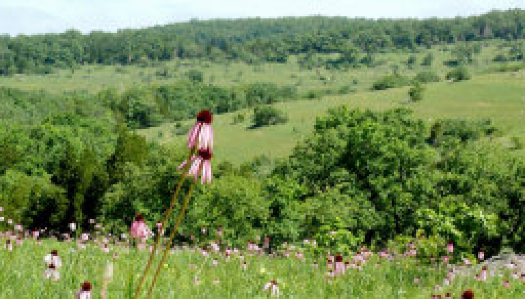
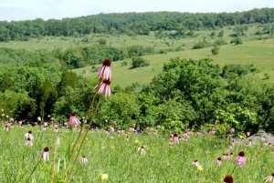
The rivers now turned slightly west of south again and entered more grassy farm country. the fields were of native grass and looked like old fields to us that had not been fertilized or farmed for a long time. There were many Ozark sundrops dotting the hillsides and they also with their startling yellow color. the Missouri Primrose (sumdrops) much larger than I had remembered and much more numerous than they were in eastern Missouri. There was a fair amount of Bluestem and Indian Grass with another covering of very tall pale purple coneflowers mixed with last years tall stand of rust colored indian grass. Prickly pears (a native Missouri cactus) were becoming more common in this section also and were in bloom too. The river itself was just a pretty as our put-in spot but was noticeably larger from the numerous springs. Very little if any gravel was present, and the bedrock was becoming blacker in color. We ran up against another low bluff, this time on the left, with an abandoned blacksmith shop on the top. The water under the bluff was so deep that we could not find the bottom, but we estimated it at fifteen feet or more. We tried to fish the hole but it was simple too deep for fly fishing. Finally at the lower end of the hole, where it began to shallow out again, I hooked a medium sized fish; and we shocked to see that it was a small walleye (know locally as Jack Salmon, or locally known as Jacks). I did not expect that at all. He too, was released unharmed to darted upstream for the bottom of the deep hole. Just below this spot, we ran across another very large school of shiners, again, maybe larger than the first. We stopped on the right (west) bank to make some map notes and correct the arial photograph as the river had moved much to the west of the location only one year ago. Also, from this point on, we began to see more creek chubs of good size and many suckers of all three types, flashing in the afternoon sun. We swam again to cool off, but the wind was not going to allow us to fly fish any more; so we put the rod away in it’s sock and tube, to protect it’s fragile tips sections and it’s single mid section.
The wind out of the south and east, the direction we were moving had now, in our estimate exceeded 30 MPH with higher gusts, at times and it was impossible to do any more exploring, mapping, or fishing. For every 100 yards we floated downstream, we were blown back about 75 yards. It was now clear that we had to completely concentrate on paddling and moving downstream do risk going under the bridge much later in the evening that we wanted too. We finally rounded a short bend and came out of the wind, “what a relief”. We both rested our arms for about ten minutes and then pushed on again through another stretch of loud white-water, this time scraping the canvas bottom badly, and that caused us really worry. No ribs were broken and no water appeared on the floor so we decided to wait to check it out when we landed for the night. Two ore quick turns to the left and then to the right and we saw the HH high bridge and new out first day was coming to an end. We had made the trip and arrived back at the car at 4:30 PM. The tent was blown down in the wind but everything else seemed in good shape. A close inspection of the canoe bottom showed a large but non-destructive scrap and several new deep scratches; but non required first aid with the patch kit. Steve K quickly cleaned the goggle-eye while I brought the Old Town up the bank, and laid in out of the wind next to the car.

